
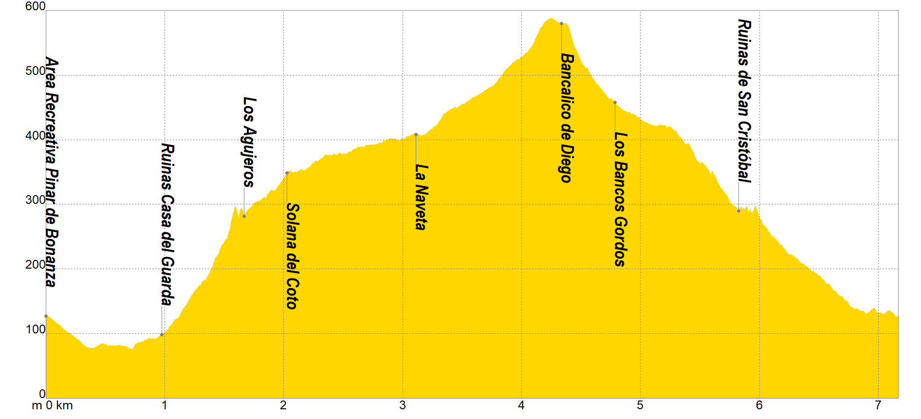
The itinerary begins in the Pinar de Bonanza Recreational Area, where we will head east along a paved road downhill until we find the track that will lead us to the Casa of the Guarda Ruins under a pleasant pine forest. From this point we will begin the ascent by turning left along a path that will take us to the delicate "Los Agujeros" pass, where we must be extremely careful. After it, we will go to a fork located in "Solana del Coto", where we will take the path that we will find ourselves on the left, which will take us to La Naveta to finally access the "Bancalico de Diego".
From the "Bancalico de Diego" we will have access to the geodesic vertex "Peña de Orihuela", which with its 634 masl is the highest point of the Range, a location that is worth visiting because it has some of the best views of the Vega Baja.
The descent will have an area in which the use of the hands will be necessary to progress, once we reach Los Bancos Gordos it will be the moment in which we will go to a section in which the DANAS will show us their destructive power, especially when Going beyond the Ruins of San Cristóbal, after this moment, only a few zigzags await us until we reach the start and end point of the itinerary while we observe the imposing walls of our steep orography.
If you want to view the route on a mobile device, scan the following QR code.


If you wish to download the map in PDF format at a scale of 1:12,500, click on the image.
If you wish to download the Track of the Tour in GPX format, click here.
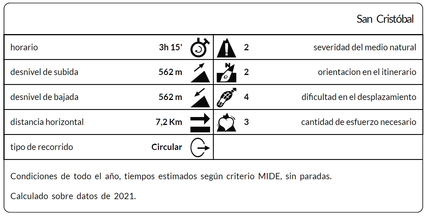
*The coding used for the assessment table of the difficulty in the route is the following:
Severity of the natural environment.
- The medium is not without risk.
- There is more than one risk factor.
- There are several risk factors.
- There are quite a few risk factors.
- There are many risk factors.
Orientation in the itinerary.
- Well defined paths and junctions.
- Trails or signage indicating continuity.
- It requires the precise identification of geographical accidents and cardinal points.
- Demands off-trace navigation.
- Navigation interrupted by obstacles that must be skirted.
Difficulty in displacement.
- Walking on a smooth surface.
- Walk along bridle paths.
- March on staggered paths or uneven terrain.
- It is necessary to use the hands or jumps to maintain balance.
- Requires the use of hands for progression.
Amount of effort required (calculated according to MIDE criteria for an average hiker lightly loaded).
- Up to 1 hour of effective walking.
- Between 1 h and 3 h of effective walking.
- Between 3 and 6 hours of actual walking.
- Between 6 and 10 hours of actual walking.
- More than 10 h of effective walking.
Tel. 96.607.61.00 Ext. 3400
Tel. 96.673.77.20
email: deportes@orihuela.es
Departamento de Administración
Tel. 611.986.082
email: administracionorihuela@aossa.es
Tel. 96.607.61.00 Ext. 3411
email: deporteescolar@orihuela.es
CDM Playas de Orihuela
Tel. 603.749.826
email: recepcionorihuela@serveo.com