
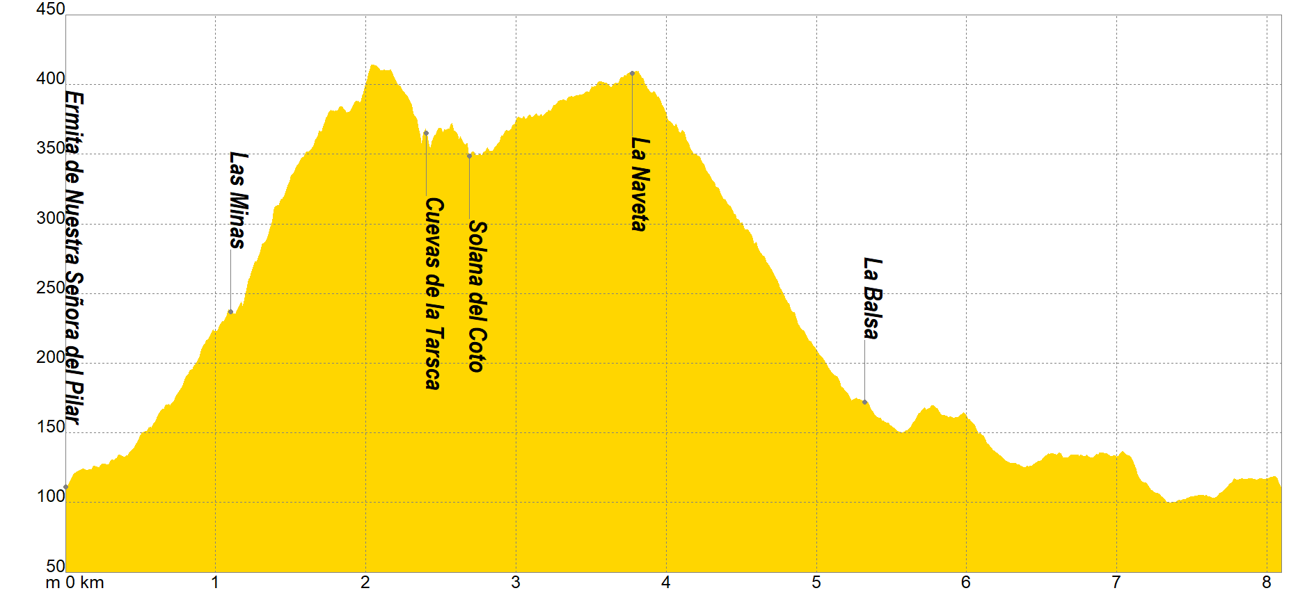
The itinerary begins in the car park located next to the Hermitage of "Nuestra Señora del Pilar" (Montepinar), continuing along a track in a South-West direction, where we will deviate a few meters away, along a path that originates on the left, spotting a large irrigation raft.
Going up said path (South), we will find ourselves at a detour through which we will turn right, entering a place with several mining excavations from the 19th century where Hematite or Oligisto were mainly extracted, but the exploitations did not turn out to be profitable and they were abandoned.
As we approach the ridge, we will find a fork with alternatives to the right and left and we will continue without deviating until we reach the Cuevas of Tarsca, where we will turn right in a sudden change of direction (From this point, facing south, we will be able to see the city ??of Orihuela).
Continuing west in the direction of Solana del Coto, we will head towards a new crossroads where we will turn right, ascending slightly to La Naveta, a place where we will see several variants, taking the one that leads us to the North face, to descend through the Barranco de la Senda, until reaching some ponds that will be the indicator that we will continue in an easterly direction skirting the slopes of the mountains along a pleasant track that will lead us to our starting point.
If you want to view the route on a mobile device, scan the following QR code.


If you wish to download the map in PDF format at a scale of 1:10,000, click on the image.
If you wish to download the Track of the Tour in GPX format, click here.
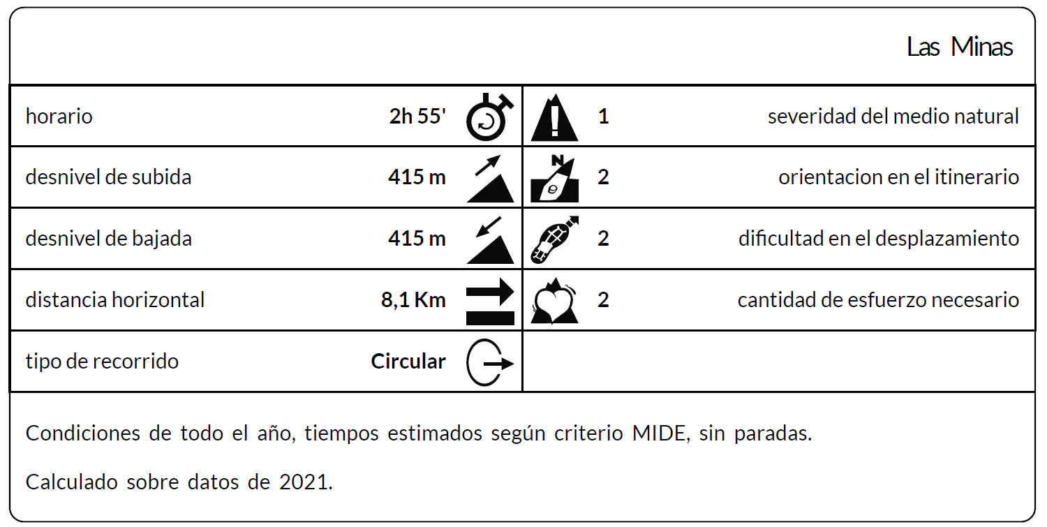
*The coding used for the assessment table of the difficulty in the route is the following:
Severity of the natural environment.
- The medium is not without risk.
- There is more than one risk factor.
- There are several risk factors.
- There are quite a few risk factors.
- There are many risk factors.
Orientation in the itinerary.
- Well defined paths and junctions.
- Trails or signage indicating continuity.
- It requires the precise identification of geographical accidents and cardinal points.
- Demands off-trace navigation.
- Navigation interrupted by obstacles that must be skirted.
Difficulty in displacement.
- Walking on a smooth surface.
- Walk along bridle paths.
- March on staggered paths or uneven terrain.
- It is necessary to use the hands or jumps to maintain balance.
- Requires the use of hands for progression.
Amount of effort required (calculated according to MIDE criteria for an average hiker lightly loaded).
- Up to 1 hour of effective walking.
- Between 1 h and 3 h of effective walking.
- Between 3 and 6 hours of actual walking.
- Between 6 and 10 hours of actual walking.
- More than 10 h of effective walking.
Tel. 96.607.61.00 Ext. 3400
Tel. 96.673.77.20
email: deportes@orihuela.es
Departamento de Administración
Tel. 611.986.082
email: administracionorihuela@aossa.es
Tel. 96.607.61.00 Ext. 3411
email: deporteescolar@orihuela.es
CDM Playas de Orihuela
Tel. 603.749.826
email: recepcionorihuela@serveo.com