
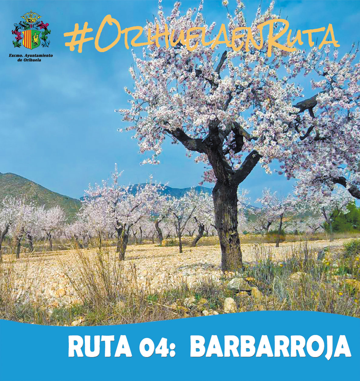
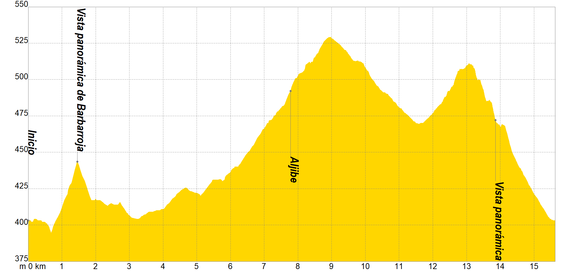
The tour begins in Barbarossa, a district belonging to the municipality of Orihuela, located at a distance of about 31 km from the city and about 3.5 km from Hondón de los Frailes. We will move along Tollo Bar street, to cross the CV-845 in the direction of Elche Bar street, which we will leave along a track belonging to the Region of Murcia to the Casa Blanca Barbarossa, now in the Valencian Community.
We will go through crops again to cross the CV-845 to reach the Barbarossa quarry, from which a characteristic marble is extracted, called Alicante red marble. Vereda street will be our next objective, crossing the Cofer boulevard twice and bordering its mountains to La Canalosa, where San Isidro avenue will lead us to the CV-843, which we will cross to continue along a forest track that will place us between the Sierra de los Frailes and the Sierra de Cofer with spectacular panoramic views.
The Collado Rumbo path and Tollo Bar street will be the last objectives of our itinerary, while we make out agriculture, mainly rainfed, whose ancient cultivation technique occurs in areas with a semi-arid climate, where efficient water management is paramount. , being its predominant crops the almond, olive, carob, barley, oats and especially the goblet-pruned vine, which gives rise to an intense, robust wine with great aromatic range.
If you want to view the route on a mobile device, scan the following QR code.


If you wish to download the map in PDF format at a scale of 1:20,000, click on the image.
If you wish to download the Track of the Tour in GPX format, click here.
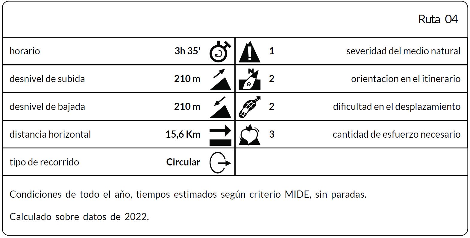
*The coding used for the assessment table of the difficulty in the route is the following:
Severity of the natural environment.
- The medium is not without risk.
- There is more than one risk factor.
- There are several risk factors.
- There are quite a few risk factors.
- There are many risk factors.
Orientation in the itinerary.
- Well defined paths and junctions.
- Trails or signage indicating continuity.
- It requires the precise identification of geographical accidents and cardinal points.
- Demands off-trace navigation.
- Navigation interrupted by obstacles that must be skirted.
Difficulty in displacement.
- Walking on a smooth surface.
- Walk along bridle paths.
- March on staggered paths or uneven terrain.
- It is necessary to use the hands or jumps to maintain balance.
- Requires the use of hands for progression.
Amount of effort required (calculated according to MIDE criteria for an average hiker lightly loaded).
- Up to 1 hour of effective walking.
- Between 1 h and 3 h of effective walking.
- Between 3 and 6 hours of actual walking.
- Between 6 and 10 hours of actual walking.
- More than 10 h of effective walking.
Tel. 96.607.61.00 Ext. 3400
Tel. 96.673.77.20
email: deportes@orihuela.es
Departamento de Administración
Tel. 611.986.082
email: administracionorihuela@aossa.es
Tel. 96.607.61.00 Ext. 3411
email: deporteescolar@orihuela.es
CDM Playas de Orihuela
Tel. 603.749.826
email: recepcionorihuela@serveo.com