
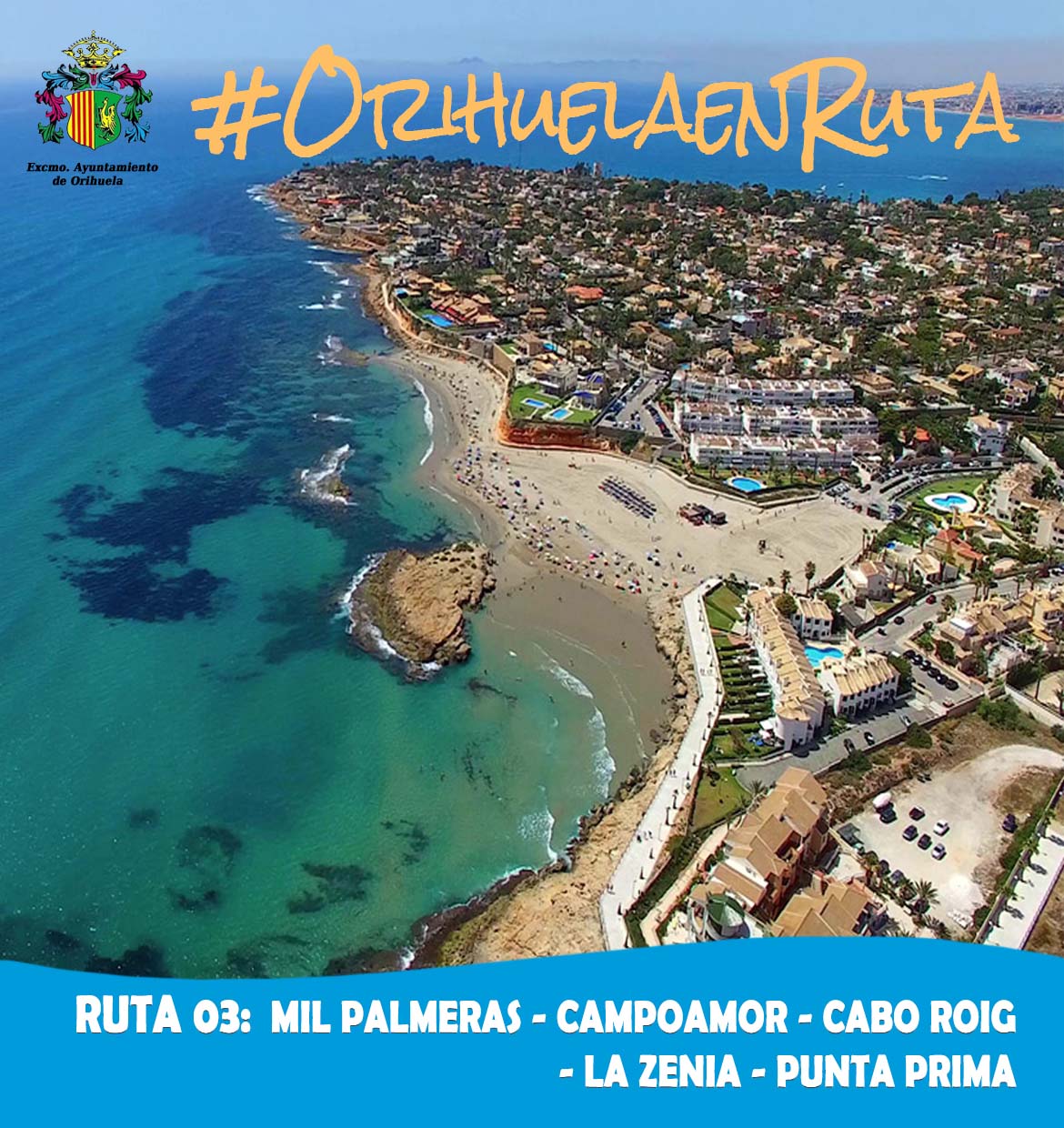
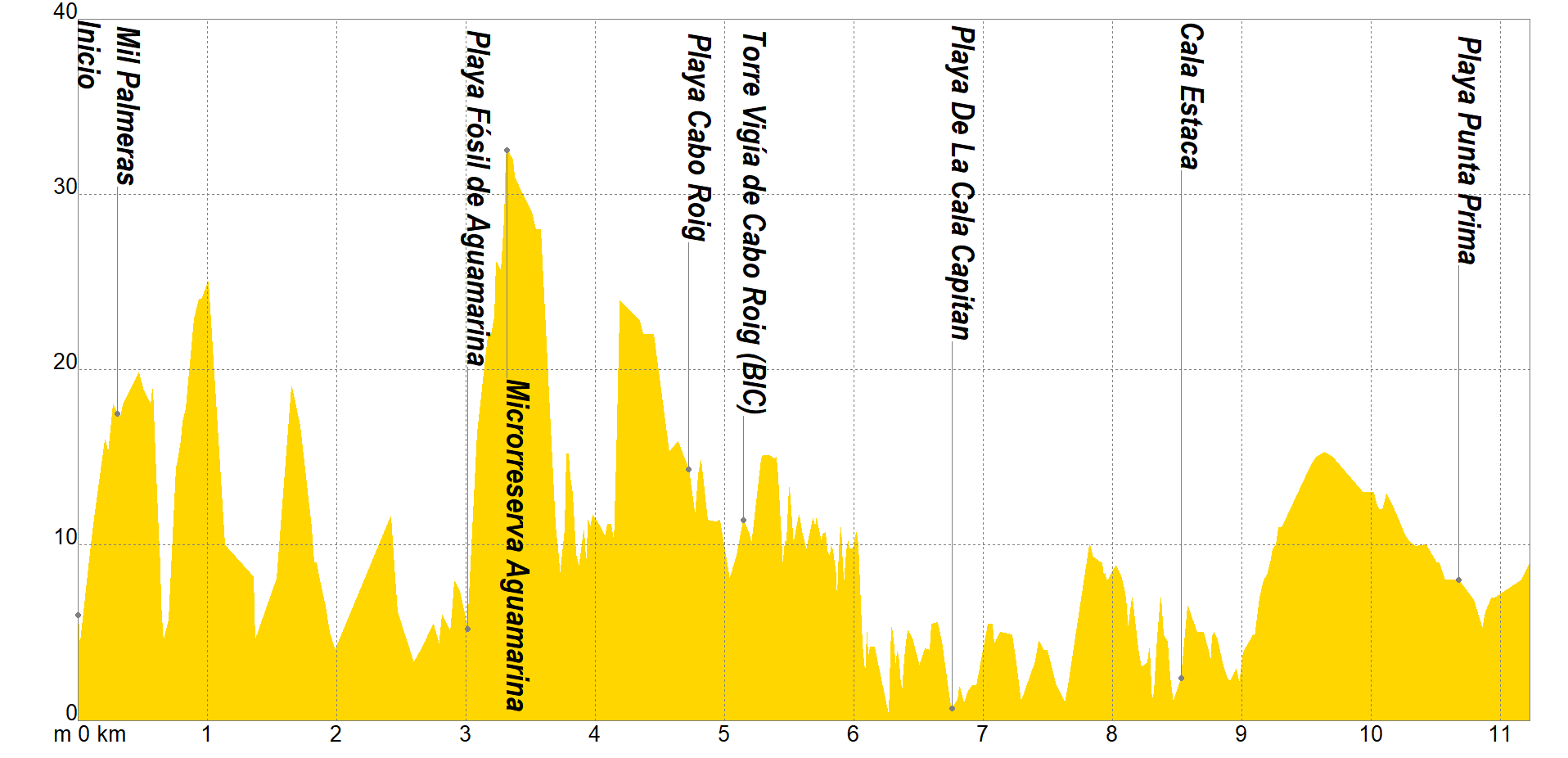
This linear route begins in the parking lot of the Mil Palmeras urbanization, heading over cliffs to the rubio ravine, which we will cross to walk through Juan Ramón Jimenez Concha Espina streets. Again with views of the sea, we will cross the Campoamor cove in the direction of La Glea beach, skirting the Miguel Caballero marina.
Once located on the aquamarine beach we will observe a formation of about 125,000 years old. In it we can find fossil remains in the sand, large areas of rocks incrusted with mollusks, as well as a landscape of very peculiar flora and fauna, as it is located a few meters from the Punta de la Glea Microreserve, considered one of the areas with the greatest plant wealth on the Oriolan coast, where various native species, some in danger of extinction, grow in the shelter of a ravine.
Our next objective will be the Cabo Roig beach, passing by its marina and watchtower, dating back to the 16th century for defensive purposes against attacks by Barbary pirates. It is a cylindrical construction recognizable by the layer of white lime that hides the original masonry work, today plastered with mortar. The entrance is located three meters high and preserves the original holes, all surrounded by ashlars that make up the edges.
There will be several coves that we still have to explore, such as Capitán, Bosque, Cerrada or La Mosca coves, the latter being a place declared a flora micro-reserve, due to the presence of an important population of the cat-headed jarilla (Helianthemum caput -felis), finding ourselves with views of the Punta Prima beach, ending this coastal itinerary in the parking lot of its renowned restaurant.
If you want to view the route on a mobile device, scan the following QR code.


If you wish to download the map in PDF format at a scale of 1:17,500, click on the image.
If you wish to download the Track of the Tour in GPX format, click here.
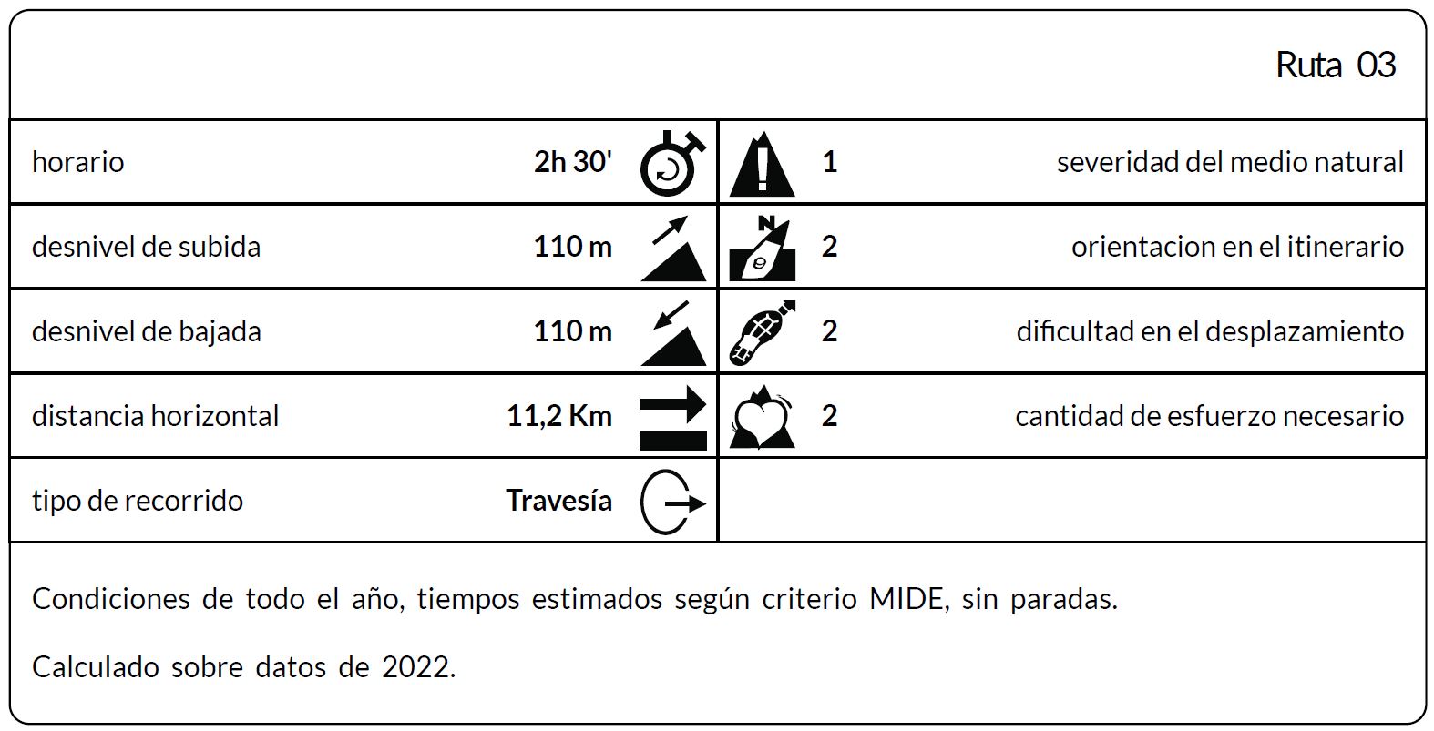
*The coding used for the assessment table of the difficulty in the route is the following:
Severity of the natural environment.
- The medium is not without risk.
- There is more than one risk factor.
- There are several risk factors.
- There are quite a few risk factors.
- There are many risk factors.
Orientation in the itinerary.
- Well defined paths and junctions.
- Trails or signage indicating continuity.
- It requires the precise identification of geographical accidents and cardinal points.
- Demands off-trace navigation.
- Navigation interrupted by obstacles that must be skirted.
Difficulty in displacement.
- Walking on a smooth surface.
- Walk along bridle paths.
- March on staggered paths or uneven terrain.
- It is necessary to use the hands or jumps to maintain balance.
- Requires the use of hands for progression.
Amount of effort required (calculated according to MIDE criteria for an average hiker lightly loaded).
- Up to 1 hour of effective walking.
- Between 1 h and 3 h of effective walking.
- Between 3 and 6 hours of actual walking.
- Between 6 and 10 hours of actual walking.
- More than 10 h of effective walking.
Tel. 96.607.61.00 Ext. 3400
Tel. 96.673.77.20
email: deportes@orihuela.es
Departamento de Administración
Tel. 611.986.082
email: administracionorihuela@aossa.es
Tel. 96.607.61.00 Ext. 3411
email: deporteescolar@orihuela.es
CDM Playas de Orihuela
Tel. 603.749.826
email: recepcionorihuela@serveo.com