
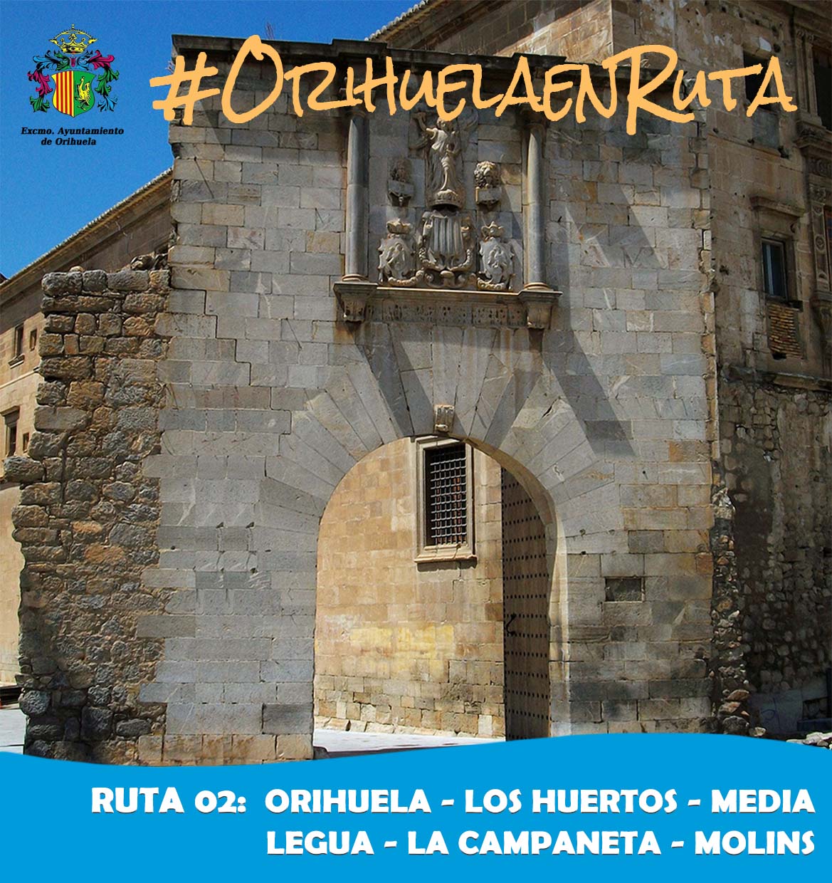
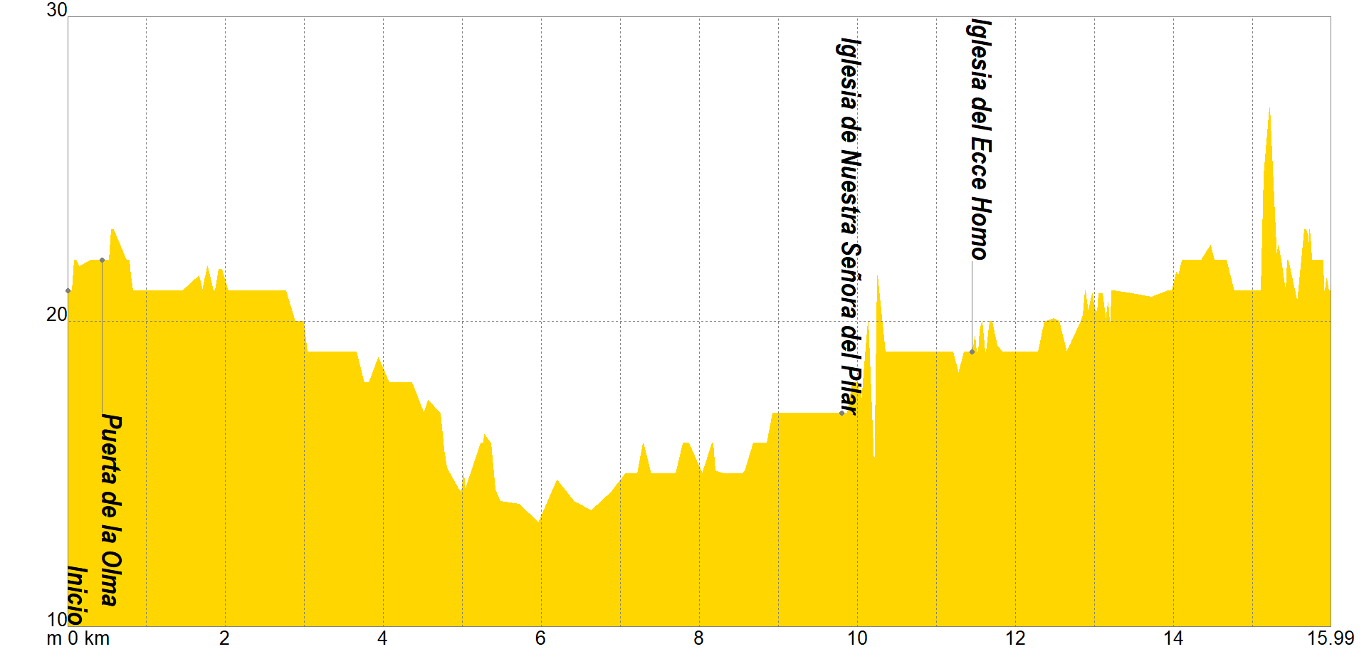
The tour begins in the Los Huertos fairground parking lot, with a large parking area, heading down Calle San Juan and later the Ronda de Santo Domingo to the Puerta de la Olma, one of the two doors that formed the wall that protected the suburb of San Juan. From this door it was possible to access the Camino Viejo de Callosa, in addition, it is the only entrance door to the city that remains standing after the collapse of the walls by order of Felipe V after the War of the Spanish Succession.
We will continue along the Camino Viejo de Callosa to enter the Senda Masquefa, which we will leave along the Vereda Ancha to finally cross the train tracks through the tunnel that will lead us to the Acequia de Millanares, next to which we will continue our itinerary.
The Vereda Don Fernando will be our next objective, crossing the CV-91 towards the Camino Viejo de Almoradí, leading us to the Church of Nuestra Señora del Pilar, declared an Asset of Local Relevance. Crossing the Segura river along the Vereda el Rincón, we will go to the Church of Ecce Homo, located in the center of the Molins district.
We will approach the Segura river along the Vereda el Marques, following its right bank until we turn off onto the CV-9220 and the Molins road. We will go up the footbridge that crosses the train tracks, making out behind it the rehabilitated bullring of Orihuela, which maintains its original historical and architectural values, indicating in turn that we only have a few meters to go along the CV-921 to our final point of the tour.
If you want to view the route on a mobile device, scan the following QR code.


If you wish to download the map in PDF format at a scale of 1:15,000, click on the image.
If you wish to download the Track of the Tour in GPX format, click here.
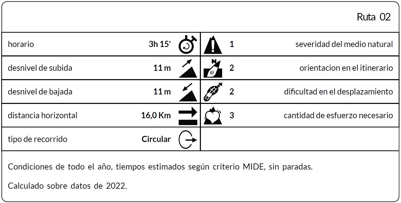
*The coding used for the assessment table of the difficulty in the route is the following:
Severity of the natural environment.
- The medium is not without risk.
- There is more than one risk factor.
- There are several risk factors.
- There are quite a few risk factors.
- There are many risk factors.
Orientation in the itinerary.
- Well defined paths and junctions.
- Trails or signage indicating continuity.
- It requires the precise identification of geographical accidents and cardinal points.
- Demands off-trace navigation.
- Navigation interrupted by obstacles that must be skirted.
Difficulty in displacement.
- Walking on a smooth surface.
- Walk along bridle paths.
- March on staggered paths or uneven terrain.
- It is necessary to use the hands or jumps to maintain balance.
- Requires the use of hands for progression.
Amount of effort required (calculated according to MIDE criteria for an average hiker lightly loaded).
- Up to 1 hour of effective walking.
- Between 1 h and 3 h of effective walking.
- Between 3 and 6 hours of actual walking.
- Between 6 and 10 hours of actual walking.
- More than 10 h of effective walking.
Tel. 96.607.61.00 Ext. 3400
Tel. 96.673.77.20
email: deportes@orihuela.es
Departamento de Administración
Tel. 611.986.082
email: administracionorihuela@aossa.es
Tel. 96.607.61.00 Ext. 3411
email: deporteescolar@orihuela.es
CDM Playas de Orihuela
Tel. 603.749.826
email: recepcionorihuela@serveo.com