
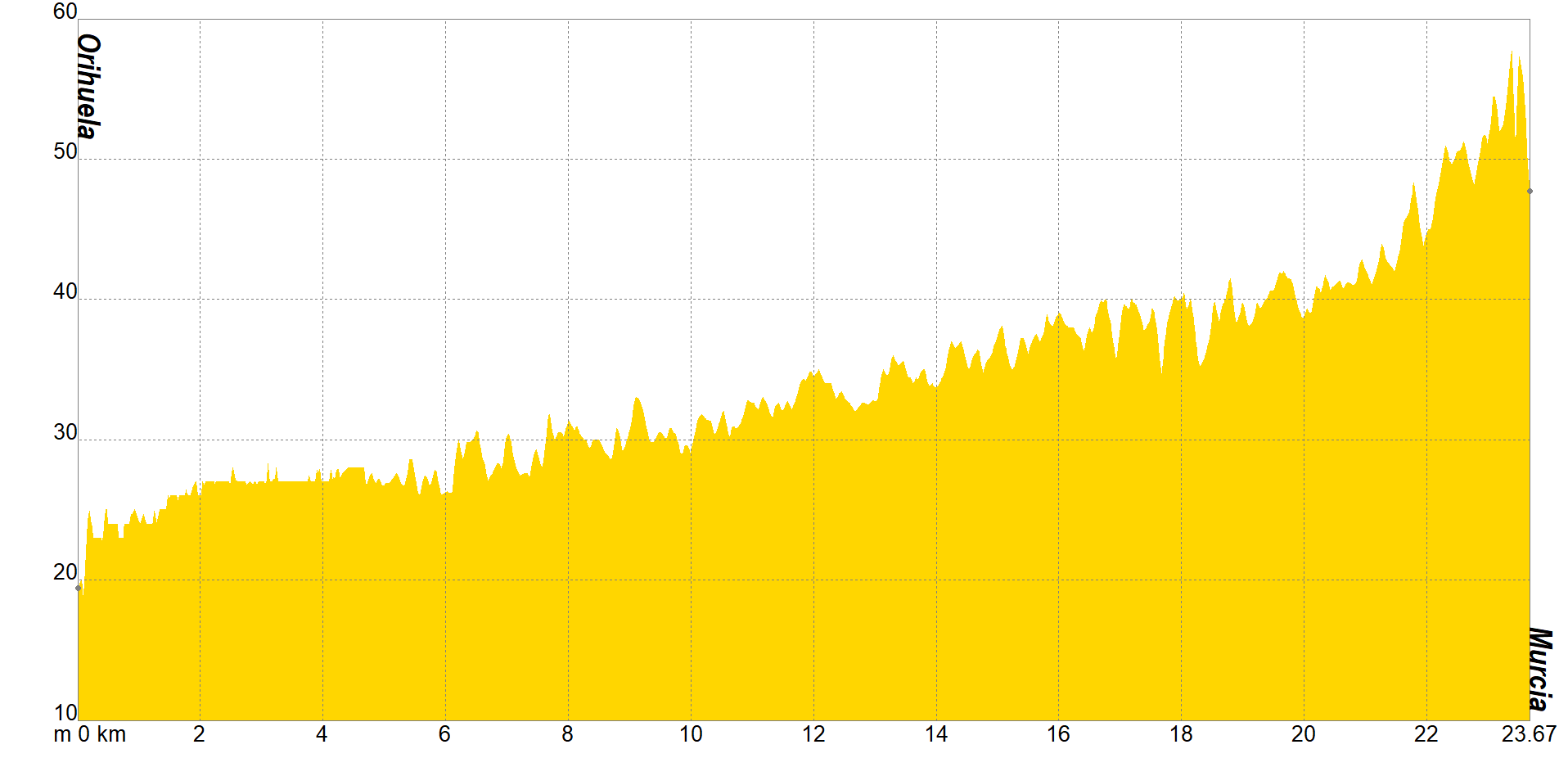
Six hours on foot separate Orihuela from Murcia, 24 kilometers, to be more exact. What is the first section of the Camino de Levante is reputed to be one of the most enjoyed by both pilgrims and hikers. If there is no rush to get to the city of the cross, it is mandatory to deviate a bit from the path to admire the church, sanctuaries and museums that will surprise you with the relics they keep behind their walls.
Most of the walkers usually make the journey in one go. They start in Orihuela, very close to the Cathedral of El Salvador, a particularly religious area, ideal for a spiritual journey and inward oneself. Those who have time prefer to complete the section in about 8 hours to make relevant stops at the church of Santas Justa y Rufina, the Archaeological Museum or the house of the great poet Miguel Hernández, located in the Alicante area.
The road signs will guide you through the countryside towards the Region of Murcia, where you will circulate along the banks of the Segura River, one of the most precious treasures of the Community, and you will be able to see first-hand the Tajo-Segura transfer, shortly after arriving in Beniel. One of the last districts through which you will pass will be that of Raal, a quiet nucleus, since the majority of its inhabitants use it as a commuter town.
During this stretch, the camera will become your most precious ally, especially if you decide to complete the Camino de Levante at Easter, Christmas or in September. And it is that it cannot be said that you have paraded through these Murcian districts if you haven't seen the Moors and Christians festival, the waterwheels in the orchard or the Living Nativity Scene of El Raal. When you have done so, you will be much closer to Murcia, where this section ends, and, therefore, to your destination.
If you want to view the route on a mobile device, scan the following QR code.


If you wish to download the map in PDF format at a scale of 1:25,000, click on the image.
If you wish to download the Track of the Tour in GPX format, click here.
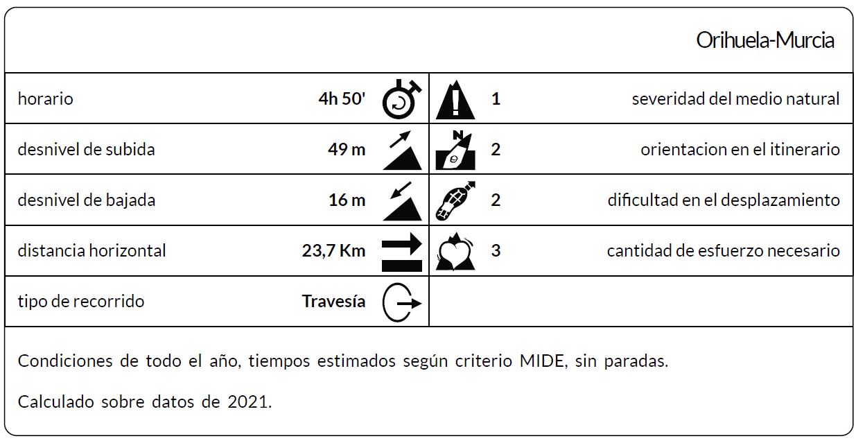
*The coding used for the assessment table of the difficulty in the route is the following:
Severity of the natural environment.
- The medium is not without risk.
- There is more than one risk factor.
- There are several risk factors.
- There are quite a few risk factors.
- There are many risk factors.
Orientation in the itinerary.
- Well defined paths and junctions.
- Trails or signage indicating continuity.
- It requires the precise identification of geographical accidents and cardinal points.
- Demands off-trace navigation.
- Navigation interrupted by obstacles that must be skirted.
Difficulty in displacement.
- Walking on a smooth surface.
- Walk along bridle paths.
- March on staggered paths or uneven terrain.
- It is necessary to use the hands or jumps to maintain balance.
- Requires the use of hands for progression.
Amount of effort required (calculated according to MIDE criteria for an average hiker lightly loaded).
- Up to 1 hour of effective walking.
- Between 1 h and 3 h of effective walking.
- Between 3 and 6 hours of actual walking.
- Between 6 and 10 hours of actual walking.
- More than 10 h of effective walking.
Tel. 96.607.61.00 Ext. 3400
Tel. 96.673.77.20
email: deportes@orihuela.es
Departamento de Administración
Tel. 611.986.082
email: administracionorihuela@aossa.es
Tel. 96.607.61.00 Ext. 3411
email: deporteescolar@orihuela.es
CDM Playas de Orihuela
Tel. 603.749.826
email: recepcionorihuela@serveo.com