
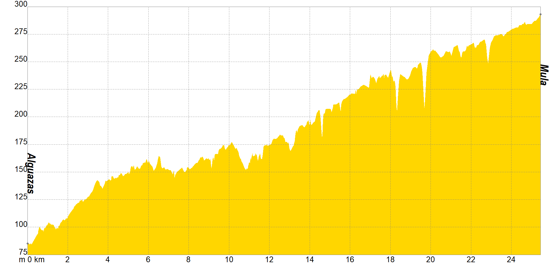
The sections of the Camino de Levante are very characteristic. And this one is particularly so. The dry fields will test your mental strength and make you realize that happiness can be achieved through little things. And it is that from Alguazas to Mula, you will know the so-called badlands, a very characteristic landscape of the area due to water erosion. This element is precisely what should not be missing in your pilgrim backpack, it is convenient to stay well hydrated during the 26 kilometers that you are going to travel to the next resting place.
The peculiarity of this section is that you can make an alternative itinerary, so that in addition to enriching yourself spiritually, it will also serve as personal growth and cultural richness. To do this, you must go to Los Rodeos, next to the Mula River, this will allow you to discover the old settlement of Campos del Río, with its typical village houses and a special charm. Follow the path towards Albudeite, where the next church awaits you: Nuestra Señora de los Remedios, one of the few located on top of a mosque.
The Region of Murcia is full of Roman remains, some remains that you will find throughout this third stage towards Caravaca de la Cruz. When you pass the highway, after Los Baños de Mula, we give you the option of detouring to the Villa Romana de Los Villaricos site and while you are there, take the opportunity to go to La Puebla de Mula, from where you can see the Castillo de Alcalá, a fortress to safeguard religious beliefs. Congratulations, you have reached your destination: Mula. You are now closer to the Vera Cruz Sanctuary.

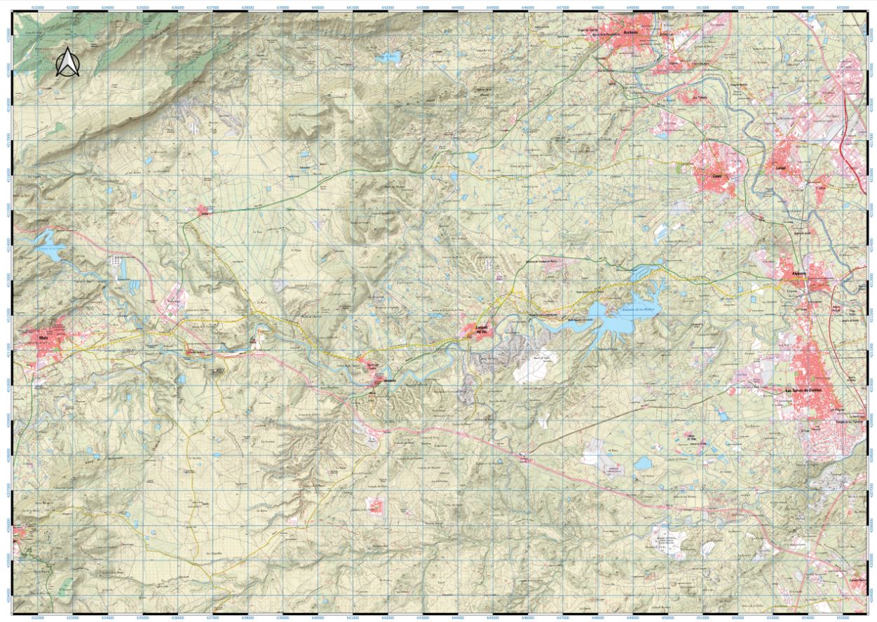
If you wish to download the map in PDF format at a scale of 1:30,000, click on the image.
If you wish to download the Track of the Tour in GPX format, click here.
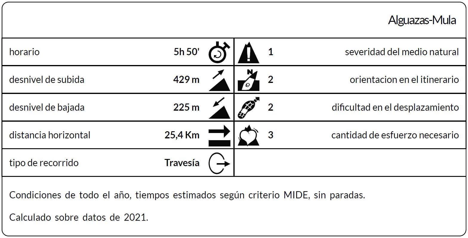
*The coding used for the assessment table of the difficulty in the route is the following:
Severity of the natural environment.
- The medium is not without risk.
- There is more than one risk factor.
- There are several risk factors.
- There are quite a few risk factors.
- There are many risk factors.
Orientation in the itinerary.
- Well defined paths and junctions.
- Trails or signage indicating continuity.
- It requires the precise identification of geographical accidents and cardinal points.
- Demands off-trace navigation.
- Navigation interrupted by obstacles that must be skirted.
Difficulty in displacement.
- Walking on a smooth surface.
- Walk along bridle paths.
- March on staggered paths or uneven terrain.
- It is necessary to use the hands or jumps to maintain balance.
- Requires the use of hands for progression.
Amount of effort required (calculated according to MIDE criteria for an average hiker lightly loaded).
- Up to 1 hour of effective walking.
- Between 1 h and 3 h of effective walking.
- Between 3 and 6 hours of actual walking.
- Between 6 and 10 hours of actual walking.
- More than 10 h of effective walking.
Tel. 96.607.61.00 Ext. 3400
Tel. 96.673.77.20
email: deportes@orihuela.es
Departamento de Administración
Tel. 611.986.082
email: administracionorihuela@aossa.es
Tel. 96.607.61.00 Ext. 3411
email: deporteescolar@orihuela.es
CDM Playas de Orihuela
Tel. 603.749.826
email: recepcionorihuela@serveo.com