
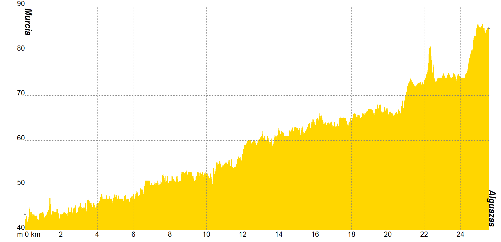
The Jubilee is one of the best times for Catholics to seek reconciliation with God. The landscape of section 2 of the Camino de Levante towards Caravaca de la Cruz invites reflection not only for Catholics, but also for anyone who decides to walk the Camino. The stage starts from Murcia in the direction of Alguazas and consists of about 26 kilometres. The most characteristic thing is that it runs through a large part of the Murcian orchard.
The first thing you will witness will be the Malecón. Do you know what its name honors? To a construction that had to stop the avenues of the Segura river. If you keep walking you will discover more secrets of the Murcia garden, such as a museum dedicated exclusively to garden products and traditions or the great wheel that is preserved in La Ñora and which is a distinctive sign of this place.
As I am sure you have already noticed, at this stage you will get to know one of the most precious natural elements in any society and, above all, in Murcia: water. Have you noticed the ditches in the orchard and the river, and how the farmers work under the intense sun?
Step by step you will reach Molina de Segura, where you can stop along the way to pray or, simply to get to know the building, at the Hermitage of Nuestra Señora de la Consolación, which dates back to the 15th century and is perfectly preserved.
And in case you didn't know, in Murcia, an ecological function has been found for the old railways. The path that will take you to Alguazas is the Vía Verde, where hundreds of cyclists and walkers pass every day. If you ever feel lost, they will guide the way.

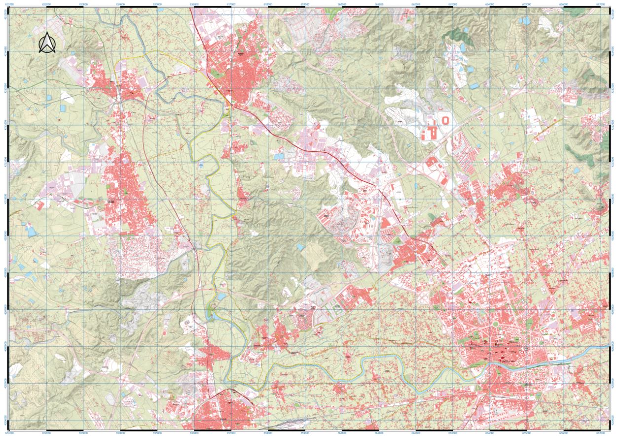
If you wish to download the map in PDF format at a scale of 1:20,000, click on the image.
If you wish to download the Track of the Tour in GPX format, click here.
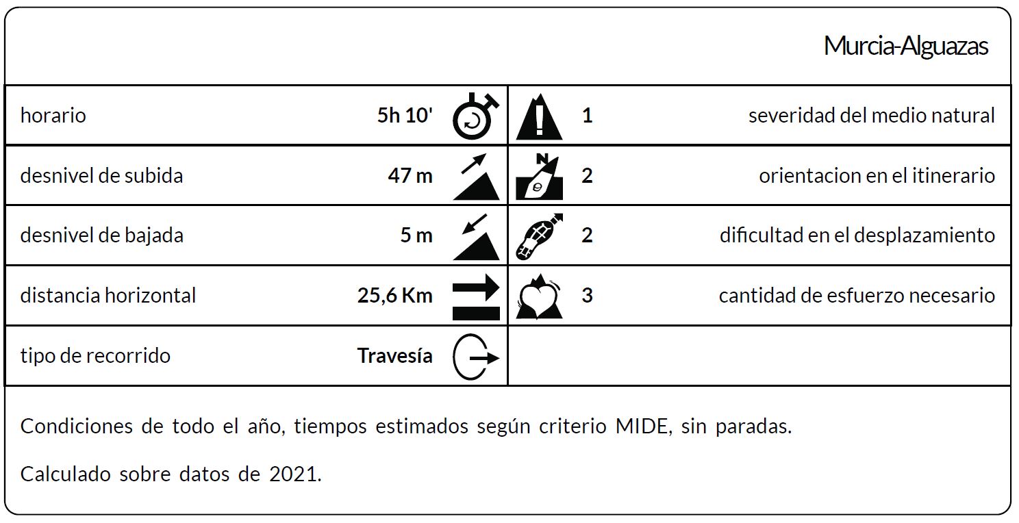
*The coding used for the assessment table of the difficulty in the route is the following:
Severity of the natural environment.
- The medium is not without risk.
- There is more than one risk factor.
- There are several risk factors.
- There are quite a few risk factors.
- There are many risk factors.
Orientation in the itinerary.
- Well defined paths and junctions.
- Trails or signage indicating continuity.
- It requires the precise identification of geographical accidents and cardinal points.
- Demands off-trace navigation.
- Navigation interrupted by obstacles that must be skirted.
Difficulty in displacement.
- Walking on a smooth surface.
- Walk along bridle paths.
- March on staggered paths or uneven terrain.
- It is necessary to use the hands or jumps to maintain balance.
- Requires the use of hands for progression.
Amount of effort required (calculated according to MIDE criteria for an average hiker lightly loaded).
- Up to 1 hour of effective walking.
- Between 1 h and 3 h of effective walking.
- Between 3 and 6 hours of actual walking.
- Between 6 and 10 hours of actual walking.
- More than 10 h of effective walking.
Tel. 96.607.61.00 Ext. 3400
Tel. 96.673.77.20
email: deportes@orihuela.es
Departamento de Administración
Tel. 611.986.082
email: administracionorihuela@aossa.es
Tel. 96.607.61.00 Ext. 3411
email: deporteescolar@orihuela.es
CDM Playas de Orihuela
Tel. 603.749.826
email: recepcionorihuela@serveo.com