
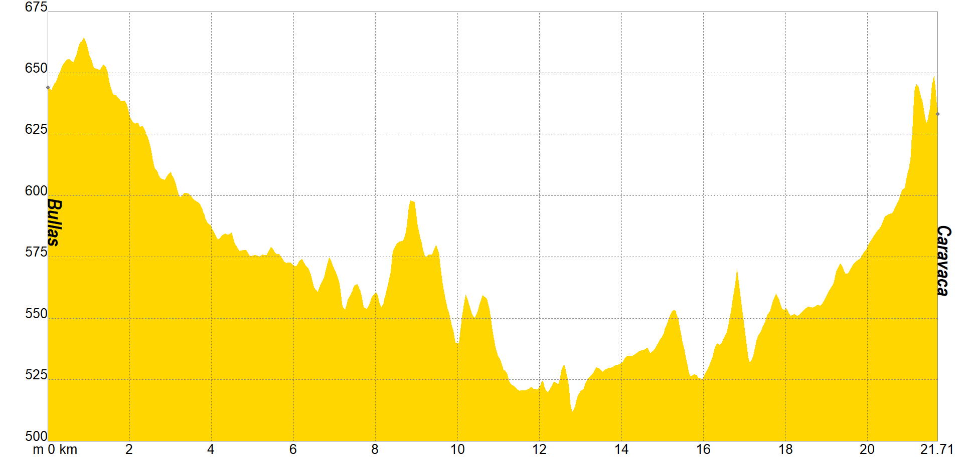
Now you are one step away from getting the Plenary Indulgence and marveling at the impressive sanctuary that Caravaca has at the top. They say that no one gives away success. The same thing happens with the Camino de Levante, this last section is the most mountainous and the hardest. There are only 21 kilometers left of the trip in which you will ascend 500 meters of altitude. Fortunately, you have a travel companion who will encourage you at all times: faith.
You will go through another old railway line, which will lead you to the Taibilla channel. From there and always among pine forests and vineyards, you will arrive at the area of Cristo Carrascalejo, where the oldest winery in Bullas is located and which combines gastronomy with the fervor of the people of Bullas, who celebrate a footkiss right there during Lent.
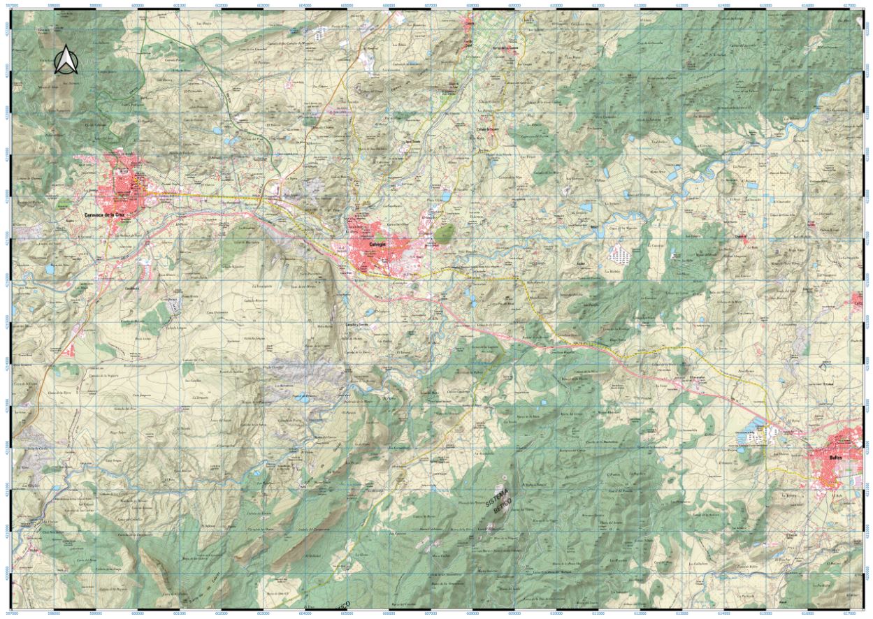
The Camino de Levante will introduce you to a large part of the towns of the Region. One of the last sections will be Cehegín, did you know that its old town has been declared a Historic Site? Walk through its little streets to discover its enormous civil and religious heritage, without forgetting to ask about the ruins of Begastri, an ancient Roman city that was the episcopal seat between the 6th and 8th centuries.
Between ruin and ruin you have arrived without hardly noticing Caravaca de la Cruz. Pilgrim, look towards the top of the hill, the Vera Cruz Sanctuary awaits you there, a few more minutes and you will be able to join the thousands of pilgrims who are already there worshiping the Vera Cruz. Without a doubt, the getaway and the effort have been worth it.

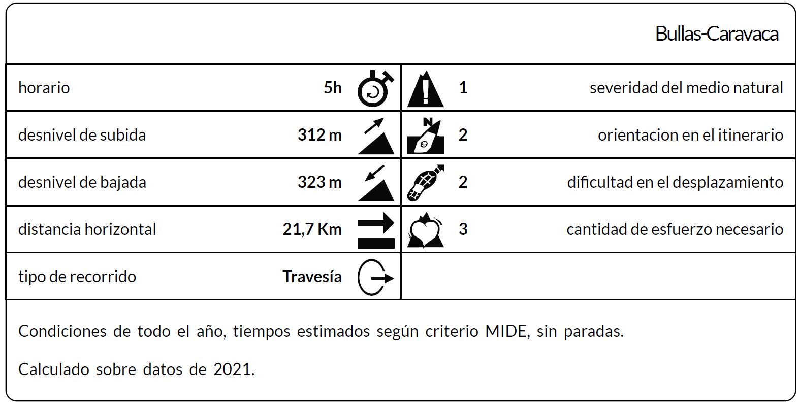
*The coding used for the assessment table of the difficulty in the route is the following:
Severity of the natural environment.
- The medium is not without risk.
- There is more than one risk factor.
- There are several risk factors.
- There are quite a few risk factors.
- There are many risk factors.
Orientation in the itinerary.
- Well defined paths and junctions.
- Trails or signage indicating continuity.
- It requires the precise identification of geographical accidents and cardinal points.
- Demands off-trace navigation.
- Navigation interrupted by obstacles that must be skirted.
Difficulty in displacement.
- Walking on a smooth surface.
- Walk along bridle paths.
- March on staggered paths or uneven terrain.
- It is necessary to use the hands or jumps to maintain balance.
- Requires the use of hands for progression.
Amount of effort required (calculated according to MIDE criteria for an average hiker lightly loaded).
- Up to 1 hour of effective walking.
- Between 1 h and 3 h of effective walking.
- Between 3 and 6 hours of actual walking.
- Between 6 and 10 hours of actual walking.
- More than 10 h of effective walking.
Tel. 96.607.61.00 Ext. 3400
Tel. 96.673.77.20
email: deportes@orihuela.es
Departamento de Administración
Tel. 611.986.082
email: administracionorihuela@aossa.es
Tel. 96.607.61.00 Ext. 3411
email: deporteescolar@orihuela.es
CDM Playas de Orihuela
Tel. 603.749.826
email: recepcionorihuela@serveo.com