
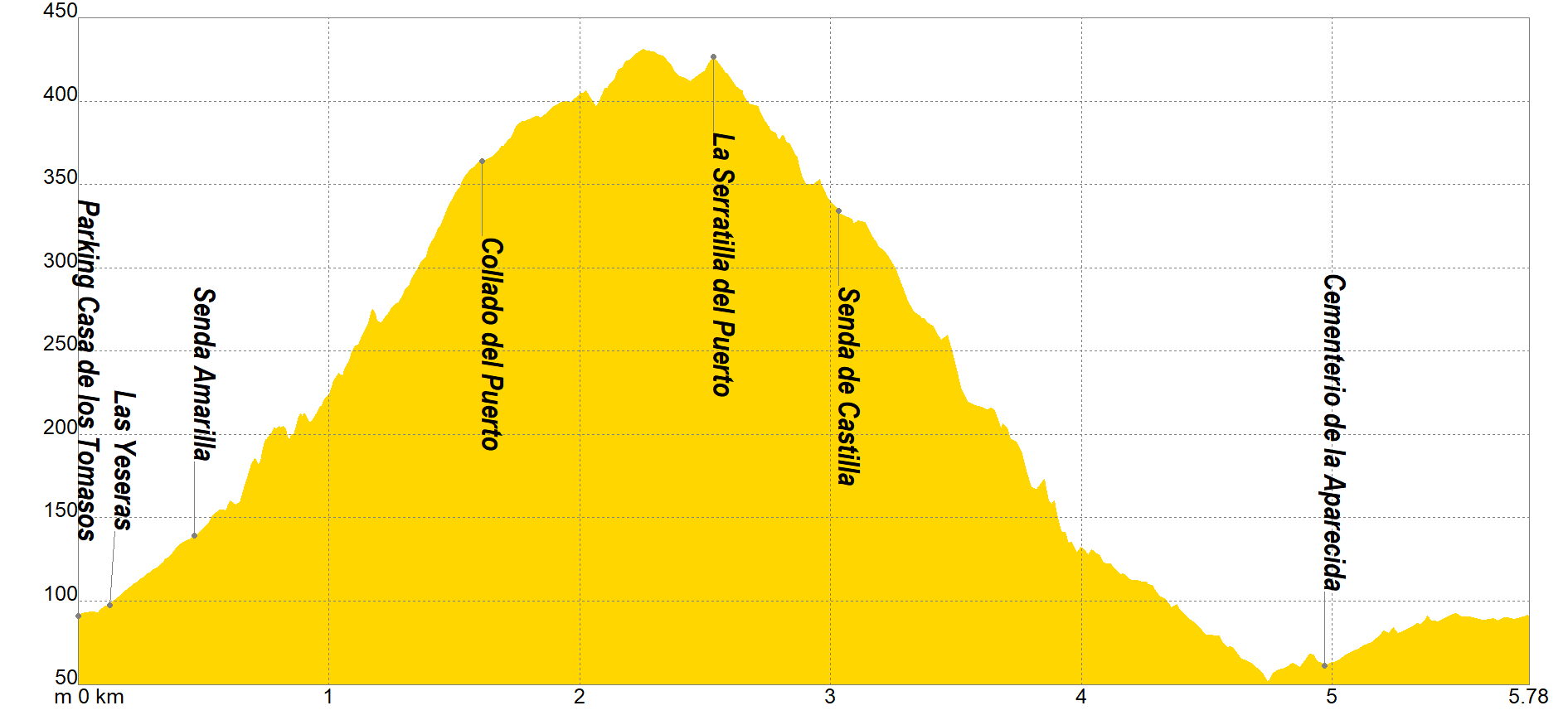
The itinerary begins at the "Casa de los Tomasos" Parking, where we will move north along the track that we will find on the right to continue until the Las Yeseras junction, where we will see various Mining Deposits. From this point we will turn left in a slight ascent towards the fork of the "Senda Amarilla" (located on the right), which we will not take as it will divert us to the San Cristobal variant.
In continuous ascent crossing and skirting ravines we will reach the "Collado del Puerto", where we will turn left, to later skirt next to the Range mountain to "Serratilla del Puerto", at this point we will have the option of ascending to "Pico del Águila" with 606 masl. Our itinerary will descend to the crossroads of the "Senda de Castilla", turning left and descending next to the "Barranco de Sanes", a section in which we will have to use our hands to progress whose slope will descend in the vicinity of the Aparecida Cemetery, where We will border the Range next to a pipe and irrigation ponds until the end of the route.
If you want to view the route on a mobile device, scan the following QR code.


If you wish to download the map in PDF format at a scale of 1:10,000, click on the image.
If you wish to download the Track of the Tour in GPX format, click here.
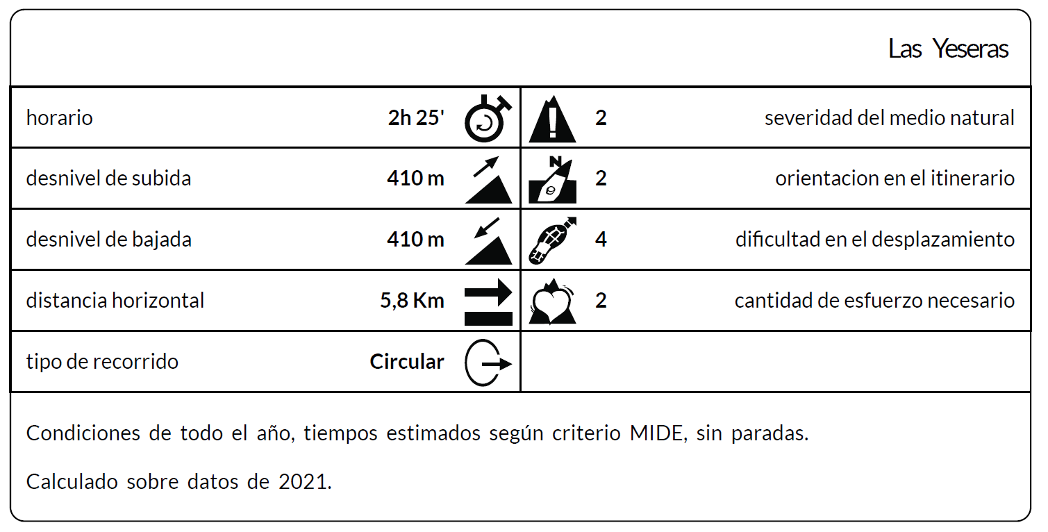
*The coding used for the assessment table of the difficulty in the route is the following:
Severity of the natural environment.
- The medium is not without risk.
- There is more than one risk factor.
- There are several risk factors.
- There are quite a few risk factors.
- There are many risk factors.
Orientation in the itinerary.
- Well defined paths and junctions.
- Trails or signage indicating continuity.
- It requires the precise identification of geographical accidents and cardinal points.
- Demands off-trace navigation.
- Navigation interrupted by obstacles that must be skirted.
Difficulty in displacement.
- Walking on a smooth surface.
- Walk along bridle paths.
- March on staggered paths or uneven terrain.
- It is necessary to use the hands or jumps to maintain balance.
- Requires the use of hands for progression.
Amount of effort required (calculated according to MIDE criteria for an average hiker lightly loaded).
- Up to 1 hour of effective walking.
- Between 1 h and 3 h of effective walking.
- Between 3 and 6 hours of actual walking.
- Between 6 and 10 hours of actual walking.
- More than 10 h of effective walking.
Introduzca texto HTML libre para explicar funcionamiento de la página, dar instrucciones,.......
Tel. 96.607.61.00 Ext. 3400
Tel. 96.673.77.20
email: deportes@orihuela.es
Departamento de Administración
Tel. 611.986.082
email: administracionorihuela@aossa.es
Tel. 96.607.61.00 Ext. 3411
email: deporteescolar@orihuela.es
CDM Playas de Orihuela
Tel. 603.749.826
email: recepcionorihuela@serveo.com